Final Science Exhibition Reflection
Thinking back to our final exhibition, I felt like I was pretty well equipped to provide people with information on my projects. Although there wasn't a super large turnout, I still felt like I was able to show my knowledge to about a dozen people, and they all seemed very intrigued. Even though I missed a large part of our map creation, I still felt pride in my work. Because I had a lot of help from my partners and teacher I was able to learn about mapping as I went and provide information on my project to people that showed up at the final exhibition.
One thing that I enjoyed about the exhibition was that we were able to display and present our maps with our groups. Working and presenting in groups gave us the ability to share our knowledge on the maps and fill in any information our partners left out while presenting. It was a good feeling knowing that you had someone there to back you up, and collaborating on these maps provided a valuable learning experience for all.
Something that I would change about the exhibition would be organization. A lot of people came by asking for directions, and it would have been nice if there were signs guiding parents and community members around the building. Besides the irony, it could have worked for maps to be placed around the building so that people could access them and find the classroom they were looking for.
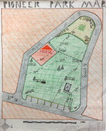
Topographic Map Project
For the topographic map project we found coordinates and headings for the Pioneer Park near Durango, CO. This project required us to piece many different parts of map-making together, and we all learned a lot about topographic mapping along the way. I feel like I learned a lot about map making processes during this project, and learned that putting the pieces of a map together can be quite a bit more challenging than having one produced by a computer.
Rube Goldberg
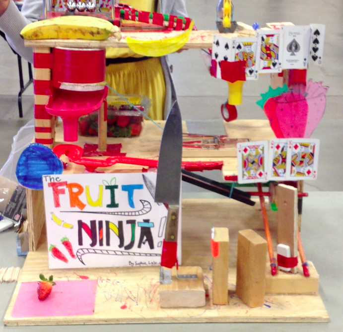
Above is a picture of the Fruit Ninja at our Rube Goldberg exhibition.
Pre-Planning For Rube Goldberg Project
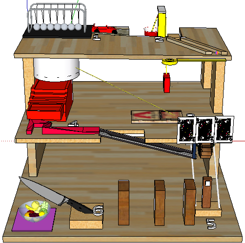
Above is the virtual model of our Rube Goldberg named the "Fruit Ninja" made in Google SkecthUp.
Rocket Reflection
|
Physics Behind the Rocket
|